


Nash & Edgecombe Counties--Rocky Mount City PUMA, North Carolina
About
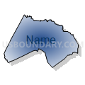
Outline

Summary
| Unique Area Identifier | 193627 |
| Name | Nash & Edgecombe Counties--Rocky Mount City PUMA |
| State | North Carolina |
| Area (square miles) | 1,049.42 |
| Land Area (square miles) | 1,045.74 |
| Water Area (square miles) | 3.68 |
| % of Land Area | 99.65 |
| % of Water Area | 0.35 |
| Latitude of the Internal Point | 35.94104550 |
| Longtitude of the Internal Point | -77.79854940 |
Maps


Graphs
Select a template below for downloading or customizing gragh for Nash & Edgecombe Counties--Rocky Mount City PUMA, North Carolina


Neighbors
Neighoring Public Use Microdata Area (by Name) Neighboring Public Use Microdata Area on the Map
- Franklin, Vance & Warren (West) Counties PUMA, NC
- Halifax, Hertford, Northampton & Warren (East) Counties PUMA, NC
- Johnston County PUMA, NC
- Pitt County--Greenville City PUMA, NC
- South & West Albemarle Sound & Northern Outer Banks Regions PUMA, NC
- Wake County (East)--Raleigh City (East), Knightdale & Garner (North) Towns PUMA, NC
- Wilson & Greene Counties--Wilson City PUMA, NC
Top 10 Neighboring County (by Population) Neighboring County on the Map
- Wake County, NC (900,993)
- Johnston County, NC (168,878)
- Pitt County, NC (168,148)
- Nash County, NC (95,840)
- Wilson County, NC (81,234)
- Franklin County, NC (60,619)
- Edgecombe County, NC (56,552)
- Halifax County, NC (54,691)
- Martin County, NC (24,505)
- Warren County, NC (20,972)
Top 10 Neighboring County Subdivision (by Population) Neighboring County Subdivision on the Map
- Stony Creek township, Nash County, NC (25,019)
- Township 12, Rocky Mount, Edgecombe County, NC (17,896)
- Rocky Mount township, Nash County, NC (16,257)
- Township 1, Tarboro, Edgecombe County, NC (15,189)
- Little River township, Wake County, NC (12,528)
- Nashville township, Nash County, NC (10,238)
- Belvoir township, Pitt County, NC (9,334)
- Taylors township, Wilson County, NC (9,001)
- O'Neals township, Johnston County, NC (8,868)
- Dunn township, Franklin County, NC (8,402)
Top 10 Neighboring Place (by Population) Neighboring Place on the Map
- Rocky Mount city, NC (57,477)
- Tarboro town, NC (11,415)
- Nashville town, NC (5,352)
- Red Oak town, NC (3,430)
- Lake Royale CDP, NC (2,506)
- Princeville town, NC (2,082)
- Sharpsburg town, NC (2,024)
- Pinetops town, NC (1,374)
- Spring Hope town, NC (1,320)
- Dortches town, NC (935)
Top 10 Neighboring Unified School District (by Population) Neighboring Unified School District on the Map
- Wake County Schools, NC (900,993)
- Johnston County Schools, NC (168,878)
- Pitt County Schools, NC (168,148)
- Nash-Rocky Mount Schools, NC (106,786)
- Wilson County Schools, NC (81,234)
- Franklin County Schools, NC (60,619)
- Edgecombe County Schools, NC (45,606)
- Halifax County Schools, NC (32,513)
- Martin County Schools, NC (24,505)
- Warren County Schools, NC (20,972)
Top 10 Neighboring State Legislative District Lower Chamber (by Population) Neighboring State Legislative District Lower Chamber on the Map
- State House District 39, NC (104,910)
- State House District 26, NC (95,937)
- State House District 49, NC (77,779)
- State House District 23, NC (75,657)
- State House District 25, NC (73,935)
- State House District 8, NC (69,997)
- State House District 27, NC (68,869)
- State House District 24, NC (62,129)
- State House District 7, NC (59,436)
Top 10 Neighboring State Legislative District Upper Chamber (by Population) Neighboring State Legislative District Upper Chamber on the Map
- State Senate District 14, NC (232,514)
- State Senate District 12, NC (210,500)
- State Senate District 7, NC (186,929)
- State Senate District 5, NC (183,899)
- State Senate District 11, NC (177,074)
- State Senate District 3, NC (167,669)
- State Senate District 4, NC (163,184)
Top 10 Neighboring 111th Congressional District (by Population) Neighboring 111th Congressional District on the Map
- Congressional District 13, NC (753,104)
- Congressional District 2, NC (741,576)
- Congressional District 3, NC (735,979)
- Congressional District 1, NC (635,936)
Top 10 Neighboring Census Tract (by Population) Neighboring Census Tract on the Map
- Census Tract 14, Wilson County, NC (8,885)
- Census Tract 111.02, Nash County, NC (7,994)
- Census Tract 108, Nash County, NC (7,195)
- Census Tract 105.02, Nash County, NC (7,060)
- Census Tract 115, Nash County, NC (6,939)
- Census Tract 103, Nash County, NC (6,574)
- Census Tract 543.02, Wake County, NC (6,564)
- Census Tract 402.01, Johnston County, NC (6,342)
- Census Tract 112, Nash County, NC (6,167)
- Census Tract 202, Edgecombe County, NC (6,059)
Top 10 Neighboring 5-Digit ZIP Code Tabulation Area (by Population) Neighboring 5-Digit ZIP Code Tabulation Area on the Map
- 27834, NC (52,914)
- 27804, NC (29,058)
- 27549, NC (24,112)
- 27597, NC (22,181)
- 27801, NC (21,740)
- 27886, NC (21,591)
- 27803, NC (21,227)
- 27896, NC (20,130)
- 27856, NC (17,141)
- 27823, NC (8,201)